18th Annual Snow Goose Festival
Field Trip: Soils, Landforms, & Vegetation of Bidwell Park
 - Sold Out!

$22 Adult; $10 Youth
Wednesday, Jan 25, 2017 7:30 am - 12:00 pm
Meet at Chico Masonic Family Center (Map)
![]() More vigorous hiking, some elevation gain/loss
More vigorous hiking, some elevation gain/loss
Description
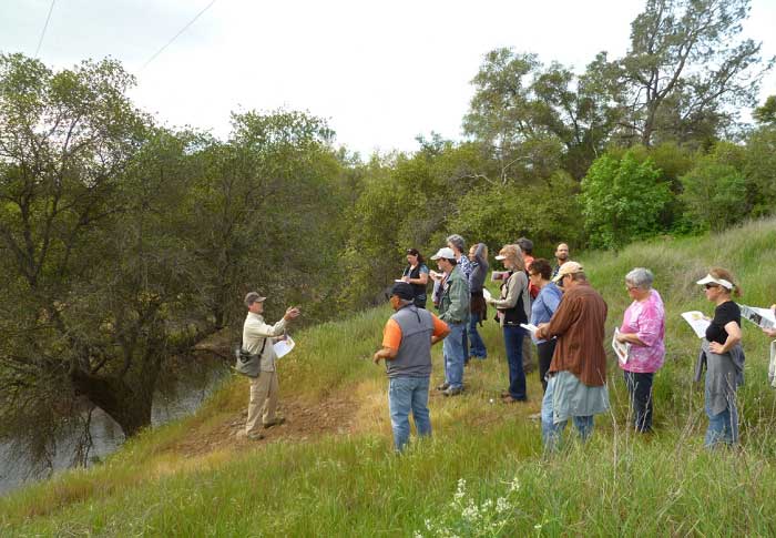
This trip begins in the flood plain of Big Chico Creek and travels back in time across the older deposits of the creek and up onto the Cascade foothills. The first route covers a condensed sequence of the major landforms that occur in the Sacramento Valley as well as the transition to the Tuscan Formation in the Cascade foothills in less than 1 mile. The second route is a 1.5 mile one-way walk up the bottom of Big Chico Creek Canyon applying what was observed on the first route and viewing the slot canyon in the Lovejoy basalt which controls the stream dynamics in this reach of the canyon. Vegetation and habitats will be correlated to soil characteristics and landforms along both routes. We will do some free-style birding on our hike back. Please bring water, snacks, and binoculars. Dress warmly and wear hiking shoes.
Field Trip Leaders
Andrew Conlin
Andrew Conlin has worked as a Soil Scientist for the NRCS for 28 years. After mapping soils in IL, MN, NY and the San Joaquin Valley, he completed the Soil Surveys of Butte County and Lassen Volcanic National Park. Andrew has provided soils tours for 20 years, explaining the relationships between soils, geomorphology, and vegetation.
Andrew Conlin's Events
- Soils, Landforms, & Vegetation of Bidwell Park (1/25/2017)
Birder, Phil Johnson
Phil Johnson has been a long time board member of the Altacal Audubon Society, and he has coordinated the Oroville and Chico Christmas Bird Counts.
Birder, Phil Johnson's Events
- Soils, Landforms, & Vegetation of Bidwell Park (1/25/2017)
